跳转到内容

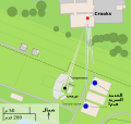
File:Assassination attempt of Donald Trump diagram.svg

页面内容不支持其他语言。
這個文件來自維基共享資源
维基百科,自由的百科全书

原始文件 (SVG文件,尺寸为512 × 486像素,文件大小:29 KB)

生成本图像。


摘要

描写
العربية: مخطط يظهر أماكن تواجد منفذ الهجوم توامس ماثيو كروكس (اللون الأحمر)، ودونالد ترامب (اللون الأسود)، وفرقة مكافحة الاعتداء للخدمة السرية (اللون الأزرق) خلال محاولة اغتيال ترامب في يوليو 2024
Deutsch: Ein Diagramm, das die ungefähren Standorte des Schützen Thomas Matthew Crooks (rot), Donald Trumps (schwarz), des Scharfschützenteams des Secret Service (blau), des tödlich verletzten Corey Comperatore (dunkelrot) und der schwer verletzten Opfer (gelb) während des versuchten Attentats auf Donald Trump im Juli 2024 zeigt
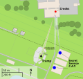
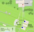
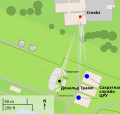
English: A diagram illustrating the approximate locations of shooter Thomas Matthew Crooks (red), Donald Trump (black), the Secret Service Counter Sniper Team (blue), fatally injured Corey Comperatore (dark red), and critically injured victims (yellow) during the attempted assassination of Donald Trump in July 2024
Français : Un diagramme illustrant les emplacements approximatifs de Thomas Matthew Crooks (rouge), Donald Trump (noir) et l'équipe de contre-embuscade (E.C.E) du Secret Service (bleu)
Nederlands: Plattegrond van de bijeenkomst tijdens de moordpoging van Donald Trump met geschatte locaties van Trump (zwart), Crooks (rood), en de tegenaanvalteam van de geheime dienst (SSCAT) (blauw)
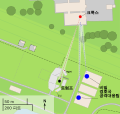
日本語: 2024年7月に発生したドナルド・トランプ暗殺未遂事件の、銃撃犯のトーマス・マシュー・クルックス(赤)、ドナルド・トランプ(黒)、シークレットサービスのカウンタースナイパー部隊及び対襲撃部隊(青)、致命傷を負ったコリー・コンペラトーレ(濃い赤)、重傷を負った被害者(黄色)のおおよその場所を示す図
本地圖以OpenStreetMap計畫資料建立,由社群收集。 此地圖可能不完整,也可能包含錯誤。別只用它當導航。
SVG开发
InfoField
 
SVG的源代码为有效代码
 
矢量图使用Inkscape创作.
 
 此SVG 文件通过SVG <switch>元素进行翻译:所有译文都保存在同一文件中。
日期
来源 openstreetmap.org
創作作者
原作者:
矢量:
OpenStreetMap 貢獻者
授权
(二次使用本文件)

OpenStreetMap的資料依據開放資料庫授權條款細節)提供。標準樣式的圖磚按照ODbL生產的作品授權。

此作品内含来自OpenStreetMap贡献者的地图资料,以开放数据库许可证(ODbL)释出。

对于从ODbL数据生成的地图,ODbL不需要任何特定许可。在2020年8月1日之前,OpenStreetMap基金会制作的地图图块已根据CC-BY-SA-2.0许可证授权。其他人制作的地图可能需要获得其他许可。

地理参考 地理参考Wikimaps Warper中的地图 如果不适当,请设置 warp_status = skip 为隐藏。
其他版本

[编辑]

File:Assassination attempt of Donald Trump diagram.svg has 18 embedded translations.
Monolingual

References

  • Sources of labeled locations:[1][2][3]
  • Location of another CS team on second building:[4]
  • Location of victims:[5][6]
  • Approximate measurements of stage, bleachers, and seats:[7][8]
  • Counter Sniper team:[9][10]

geohack maps

  1. (2024-07-13). "Shooting at a Trump Rally in Pennsylvania: Maps and Photos". The New York Times. ISSN 0362-4331.
  2. Trump injured, rushed from stage after shooter fired on his Pennsylvania rally (in en). NBC News (2024-07-13). Archived from the original on July 14, 2024. Retrieved on 2024-07-14.
  3. Sky News (2024-07-14). Trump shooting: Gunman identified as video shows body and rifle on roof. Sky News. Retrieved on 2024-07-15.
  4. The Wall Street Journal (2024-07-14). How Donald Trump’s Attempted Assassination Unfolded. YouTube. Retrieved on 2024-07-14.
  5. (2024-7-16). "Minute-by-minute: Visual timeline of the Trump assassination attempt". CNN.
  6. Storyful News & Weather (2024-07-14). Bloodied Person Carried Away From Stands Following Shooting at Trump Rally. YouTube. Retrieved on 2024-07-15.
  7. Aerial footage of scene after shooting at Trump rally in Butler, Pennsylvania. WFXG FOX54 (2024-07-13). Retrieved on 2024-07-14.
  8. https://media-cldnry.s-nbcnews.com/image/upload/q_auto:best/rockcms/2024-07/240714-donald-trump-butler-rally-shooting-aftermath-wm-129p-6af977.jpg
  9. United States Secret Service (n.d.). Special Operations Division. Retrieved on 2024-07-15.
  10. United States Secret Service (2024-07-15). Statement From U.S. Secret Service Director Kimberly Cheatle.

许可协议

此作品内含来自OpenStreetMap贡献者的地图资料,以开放数据库许可证(ODbL)释出。

对于从ODbL数据生成的地图,ODbL不需要任何特定许可。在2020年8月1日之前,OpenStreetMap基金会制作的地图图块已根据CC-BY-SA-2.0许可证授权。其他人制作的地图可能需要获得其他许可。

说明

添加一行文字以描述该文件所表现的内容
A diagram illustrating the approximate locations of Thomas Matthew Crooks (red), Donald Trump (black), and the Secret Service Counter Sniper Team (blue)

image/svg+xml

文件历史

点击某个日期/时间查看对应时刻的文件。

最新 | 最旧) 查看(较新10条 | )(10 | 20 | 50 | 100 | 250 | 500
日期/时间缩⁠略⁠图大小用户备注
当前2024年8月9日 (五) 17:262024年8月9日 (五) 17:26版本的缩略图512 × 486(29 KB)Sebbog13File uploaded using svgtranslate tool (https://svgtranslate.toolforge.org/). Added translation for nb.
2024年8月9日 (五) 14:482024年8月9日 (五) 14:48版本的缩略图512 × 486(29 KB)Glrxforgot to fix ids // Editing SVG source code using c:User:Rillke/SVGedit.js
2024年8月9日 (五) 14:472024年8月9日 (五) 14:47版本的缩略图512 × 486(29 KB)Glrxes: herido gravemente // Editing SVG source code using c:User:Rillke/SVGedit.js
2024年7月26日 (五) 03:122024年7月26日 (五) 03:12版本的缩略图512 × 486(29 KB)JojoyeeFile uploaded using svgtranslate tool (https://svgtranslate.toolforge.org/). Added translation for zh-my.
2024年7月23日 (二) 06:272024年7月23日 (二) 06:27版本的缩略图512 × 486(28 KB)Momiji-PenguinFile uploaded using svgtranslate tool (https://svgtranslate.toolforge.org/). Added translation for ja.
2024年7月23日 (二) 06:242024年7月23日 (二) 06:24版本的缩略图512 × 486(28 KB)Momiji-PenguinFile uploaded using svgtranslate tool (https://svgtranslate.toolforge.org/). Added translation for ja.
2024年7月23日 (二) 06:172024年7月23日 (二) 06:17版本的缩略图512 × 486(28 KB)Momiji-PenguinFile uploaded using svgtranslate tool (https://svgtranslate.toolforge.org/). Added translation for ja.
2024年7月20日 (六) 14:052024年7月20日 (六) 14:05版本的缩略图512 × 486(27 KB)GlrxCSS for Hebrew // Editing SVG source code using c:User:Rillke/SVGedit.js
2024年7月20日 (六) 11:312024年7月20日 (六) 11:31版本的缩略图512 × 486(27 KB)ערןFile uploaded using svgtranslate tool (https://svgtranslate.toolforge.org/). Added translation for he.
2024年7月20日 (六) 02:362024年7月20日 (六) 02:36版本的缩略图512 × 486(26 KB)Glrxsimplify transforms
最新 | 最旧) 查看(较新10条 | )(10 | 20 | 50 | 100 | 250 | 500

以下页面使用本文件:

全域文件用途

以下其他wiki使用此文件:

元数据