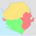
File:Sierra Leone location map.svg

此SVG文件的PNG预览的大小:600 × 600像素。 其他分辨率:240 × 240像素 | 480 × 480像素 | 768 × 768像素 | 1,024 × 1,024像素 | 2,048 × 2,048像素 | 1,607 × 1,607像素。
原始文件 (SVG文件,尺寸为1,607 × 1,607像素,文件大小:244 KB)
文件历史
点击某个日期/时间查看对应时刻的文件。
| 日期/时间 | 缩略图 | 大小 | 用户 | 备注 | |
|---|---|---|---|---|---|
| 当前 | 2008年12月10日 (三) 19:39 |  | 1,607 × 1,607(244 KB) | NordNordWest | {{Information |Description= {{de|Positionskarte von Sierra Leone}} Quadratische Plattkarte. Geographische Begrenzung der Karte: * N: 10.2° N * S: 6.8° N * W: 13.5° W * O: 10.1° W {{en|Location map of [[:en:Sierra Leone|Sierra Leon |
文件用途
以下12个页面使用本文件:
全域文件用途
以下其他wiki使用此文件:
- af.wikipedia.org上的用途
- am.wikipedia.org上的用途
- an.wikipedia.org上的用途
- ar.wikipedia.org上的用途
- az.wikipedia.org上的用途
- be-tarask.wikipedia.org上的用途
- be.wikipedia.org上的用途
- bg.wikipedia.org上的用途
- bn.wikipedia.org上的用途
- bs.wikipedia.org上的用途
- ceb.wikipedia.org上的用途
查看此文件的更多全域用途。


