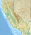
File:United States San Francisco Bay Area location map.svg

此 SVG 檔案的 PNG 預覽的大小:100 × 120 像素。 其他解析度:200 × 240 像素 | 400 × 480 像素 | 640 × 768 像素 | 853 × 1,024 像素 | 1,707 × 2,048 像素。
原始檔案 (SVG 檔案,表面大小:100 × 120 像素,檔案大小:1.29 MB)
檔案歷史
點選日期/時間以檢視該時間的檔案版本。
| 日期/時間 | 縮圖 | 尺寸 | 使用者 | 備註 | |
|---|---|---|---|---|---|
| 目前 | 2017年10月27日 (五) 15:31 |  | 100 × 120(1.29 MB) | Mliu92 | Fix visibility of small islands in North Bay |
| 2017年10月27日 (五) 15:28 |  | 100 × 120(1.29 MB) | Mliu92 | User created page with UploadWizard |
檔案用途
下列2個頁面有用到此檔案:
全域檔案使用狀況
以下其他 wiki 使用了這個檔案:
- en.wikipedia.org 的使用狀況
- Berkeley, California
- Alcatraz Island
- Colma, California
- Yerba Buena Island
- Treasure Island, San Francisco
- Angel Island (California)
- Mare Island
- Suisun Bay
- Farallon Islands
- Mount Davidson (California)
- Hog Island (Tomales Bay)
- San Bruno Mountain
- Red Rock Island
- Bair Island
- Brooks Island Regional Preserve
- The Brothers (San Francisco Bay)
- Marin Islands
- Seal Rocks (San Francisco, California)
- Coast Guard Island
- Richardson Bay
- Emeryville Crescent State Marine Reserve
- Bay Farm Island, Alameda, California
- Mussel Rock
- Montara Mountain
- The Sisters (California)
- Purisima Creek Redwoods Open Space Preserve
- Castro Rocks
- Hydrography of the San Francisco Bay Area
- Grizzly Bay
- Kent Island (California)
- Hog Island (Petaluma River)
- Bird Island (Marin County, California)
- Gull Rock
- Belvedere Island
- San Pedro Rock
- Seal Rock (San Mateo County, California)
- Sports in the San Francisco Bay Area
- Ecology of the San Francisco Estuary
- List of islands of California
- Sunset Reservoir
- Marsh Creek (California)
- Skaggs Island Naval Communication Station
- Alameda (island)
- 1984 Summer Olympics torch relay
- Belmont Slough
- User:JPxG
- Fort Barry
- Module:Location map/data/United States San Francisco Bay Area/doc
- Module:Location map/data/United States San Francisco Bay Area
- Greco Island
檢視此檔案的更多全域使用狀況。


