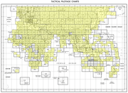
File:Txu-pclmaps-oclc-22834566 g-7a.jpg

預覽大小:800 × 574 像素。 其他解析度:320 × 230 像素 | 640 × 459 像素 | 1,024 × 735 像素 | 1,280 × 918 像素 | 2,560 × 1,836 像素 | 9,354 × 6,710 像素。
原始檔案 (9,354 × 6,710 像素,檔案大小:26.09 MB,MIME 類型:image/jpeg)
檔案歷史
點選日期/時間以檢視該時間的檔案版本。
| 日期/時間 | 縮圖 | 尺寸 | 使用者 | 備註 | |
|---|---|---|---|---|---|
| 目前 | 2019年12月27日 (五) 11:27 |  | 9,354 × 6,710(26.09 MB) | Geographyinitiative | User created page with UploadWizard |
檔案用途
下列2個頁面有用到此檔案:
全域檔案使用狀況
以下其他 wiki 使用了這個檔案:
- az.wikipedia.org 的使用狀況
- en.wikipedia.org 的使用狀況
- Yarkant County
- Artush
- Kashgar Prefecture
- Poskam County, Xinjiang
- Maralbexi County
- Payzawat County
- Kargilik County
- Yopurga County
- Makit County
- Yengisar County
- Akto County
- Qira County
- Lop County
- Shule County
- Hotan Prefecture
- Kokyar
- Pishan hostage crisis
- Mazartag
- Seriqbuya
- Afghanistan–China border
- China–Tajikistan border
- Baykurut
- Koxtag
- Muji Town, Hotan
- Kezi River
- en.wiktionary.org 的使用狀況
- es.wikipedia.org 的使用狀況
- ja.wikipedia.org 的使用狀況
- ro.wikipedia.org 的使用狀況
- ru.wikipedia.org 的使用狀況
- uz.wikipedia.org 的使用狀況


