跳至內容

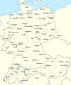
File:Rzeczpospolita 1937.svg

頁面內容不支援其他語言。
這個檔案來自維基共享資源
維基百科,自由的百科全書

原始檔案 (SVG 檔案,表面大小:2,220 × 1,554 像素,檔案大小:573 KB)


摘要

描述 Test version of a vectorized File:Rzeczpospolita 1920.png; more changes will follow, only checking if wiki displays it right
日期
來源

自己的作品; based on an earlier raster map made in 2005, as well as similar maps made by myself in 2004 (see below).
In preparation of this map I used many other maps as sources and backup. Among them were:

  • a German roadmap of Poland printed in 1938 (colours and the shape of East Prussian border)
  • and perhaps a dozen others.
作者 Halibutt
其他版本
SVG開發
InfoField
 
SVG檔案的原始碼無效,因為出現2個錯誤。
 
以及使用 Inkscape.
 
 這個SVG 檔案使用了內置文字,可以使用任何文字編輯器輕鬆翻譯


Copyright notice: Image made by Halibutt and uploaded to Wikipedia by the author. Images can be made available for use under other copyleft licenses on a case by case basis via direct contact with the author. Under moral rights the user requires that this work be properly attributed to its creator. For photographs, this is traditionally done in the image caption. Where a copyright notice is present, using the copyright notice in the caption will be sufficient. Note that the GFDL requires that any copyright notices be included with the work even when making unmodified use of it.

Since the legal status of the above comment has been questioned, I hereby grant anyone the right to treat it as either a standard copyright notice, invariant section, legal statement, legal advice, friendly suggestion or a mere comment, depending on his or hers own choice.
Halibutt
GNU head 已授權您依據自由軟體基金會發行的無固定段落、封面文字和封底文字GNU自由文件授權條款1.2版或任意後續版本,對本檔進行複製、傳播和/或修改。該協議的副本列在GNU自由文件授權條款中。
w:zh:創用CC
姓名標示 相同方式分享
此檔案採用創用CC 姓名標示-相同方式分享 3.0 未在地化版本授權條款。
您可以自由:
  • 分享 – 複製、發佈和傳播本作品
  • 重新修改 – 創作演繹作品
惟需遵照下列條件:
  • 姓名標示 – 您必須指名出正確的製作者,和提供授權條款的連結,以及表示是否有對內容上做出變更。您可以用任何合理的方式來行動,但不得以任何方式表明授權條款是對您許可或是由您所使用。
  • 相同方式分享 – 如果您利用本素材進行再混合、轉換或創作,您必須基於如同原先的相同或兼容的條款,來分布您的貢獻成品。
已新增授權條款標題至此檔案,作為GFDL授權更新的一部份。

The following is a list of maps created by Halibutt and uploaded to commons, as well as their present and projected derivatives.

Parent Image Image Description
  Maps by Halibutt
Image:Rzeczpospolita.png Image:Rzeczpospolita.png The Republic in 17th and 18th century
Image:Rzeczpospolita 1600.png The Republic after the Treaty of Dywilino
Image:Rzeczpospolita voivodships.png Voivodships of The Republic
Image:Rzeczpospolita_Potop.png The Republic during The Deluge and Chmielnicki Uprising, with major battles of the era marked
Magnates and their lands and domains
1st2nd3rd Partitions of Poland
War of the constitution
Image:Rzeczpospolita.xcf SOURCE FILE - GIMP format
Image:Poland 1939.png Image:Poland 1939.png Poland in 1939
Image:Dywizje wrzesien 1.png Order of Battle on September 1st, during the Polish Defence War of 1939
Image:Poland 1939.xcf SOURCE FILE - GIMP format
Image:Polska kontur bialy.png Image:Polska kontur bialy.png Contour map of Poland AD 1999, for use with various locator maps
Image:Rzeczpospolita 1923.png Image:Rzeczpospolita 1923.png Map of Poland 1918-1939, currently under development
Image:PBW March 1919.png Polish-Bolshevik War - fronts in March of 1919
Image:PBW December 1919.png Polish-Bolshevik War - fronts in December of 1919
Image:PBW June 1920.png Polish-Bolshevik War - fronts in July of 1920
Image:PBW August 1920.png Polish-Bolshevik War - fronts in August of 1920
Polish Defence War of 1939
Polish areas annexed by Germany, Lithuania, Slovakia and the Soviet Union
German concentration camps in Poland
Curzon line
Major battles of the Polish-Bolshevik War
namesno names Polish/Czechoslovak/Lithuanian/German/Ukrainian claims in 1920's
Image:Rzeczpospolita Central Lithuania.png Central Lithuania
Image:Rzeczpospolita Lithuania claims.png Central Lithuania as compared with other Lithuanian claims
Image:Rzeczpospolita 1789-1920.png Post-1922 borders compared with the territory of Poland before the partitions
Warsaw Uprising and the Operation Tempest
Poland partitioned between the Soviets and the Germans
Image:Rzeczpospolita 1939 Polish divisions.png Polish divisions on September 1, 1939
Home Army inspectorates
Image:Rzeczpospolita 1922.xcf SOURCE FILE - GIMP format
Image:Rzeczpospolita 1937.svg Vector version!!!! layered version available on request

說明

添加單行說明來描述出檔案所代表的內容

在此檔案描寫的項目

描繪內容

檔案歷史

點選日期/時間以檢視該時間的檔案版本。

最新 | 最早) 檢視(較新 10 筆 | )(10 | 20 | 50 | 100 | 250 | 500
日期/時間縮⁠圖尺寸使用者備⁠註
目前2017年1月1日 (日) 15:24於 2017年1月1日 (日) 15:24 版本的縮圖2,220 × 1,554(573 KB)Sascha GPDMalmö (duplicate) -> Göteborg
2013年7月30日 (二) 14:34於 2013年7月30日 (二) 14:34 版本的縮圖2,220 × 1,554(573 KB)HalibuttAdded some rivers in Russia, corrected others (RO, HU, PL)
2013年7月30日 (二) 03:28於 2013年7月30日 (二) 03:28 版本的縮圖2,220 × 1,563(458 KB)HalibuttSweden corrected (town names added)
2013年7月30日 (二) 03:16於 2013年7月30日 (二) 03:16 版本的縮圖2,214 × 1,567(492 KB)Halibuttcrunched version (deleted background layers)
2013年7月30日 (二) 03:13於 2013年7月30日 (二) 03:13 版本的縮圖2,214 × 1,567(3.68 MB)Halibuttlet's see if the expanded version works
2010年7月16日 (五) 18:11於 2010年7月16日 (五) 18:11 版本的縮圖2,014 × 1,567(534 KB)HierakaresCorrected position of name Oppeln which was overlapping with point.
2008年3月14日 (五) 08:54於 2008年3月14日 (五) 08:54 版本的縮圖2,014 × 1,567(534 KB)HalibuttNames of larger towns enlarged
2008年3月14日 (五) 08:45於 2008年3月14日 (五) 08:45 版本的縮圖2,014 × 1,567(533 KB)Halibuttversion corrected by Madman
2008年3月14日 (五) 00:30於 2008年3月14日 (五) 00:30 版本的縮圖2,000 × 1,534(512 KB)Halibutt{{Information |Description= |Source=self-made |Date= |Author= Halibutt |Permission= |other_versions= }}
2008年3月13日 (四) 23:54於 2008年3月13日 (四) 23:54 版本的縮圖2,000 × 1,534(548 KB)Halibutt{{Information |Description= |Source=self-made |Date= |Author= Halibutt |Permission= |other_versions= }}
最新 | 最早) 檢視(較新 10 筆 | )(10 | 20 | 50 | 100 | 250 | 500

下列頁面有用到此檔案:

全域檔案使用狀況

以下其他 wiki 使用了這個檔案:

檢視此檔案的更多全域使用狀況

詮釋資料